Gate of La Barcina
Published: May 16, 2020
Gate of La Barcina
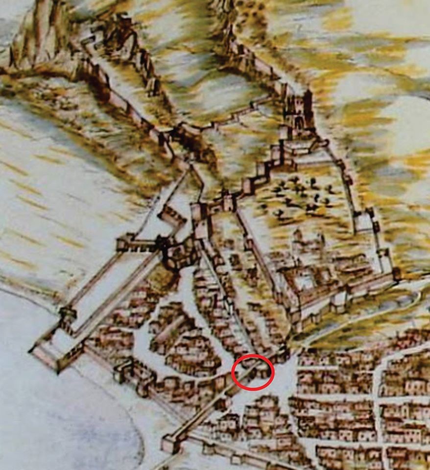
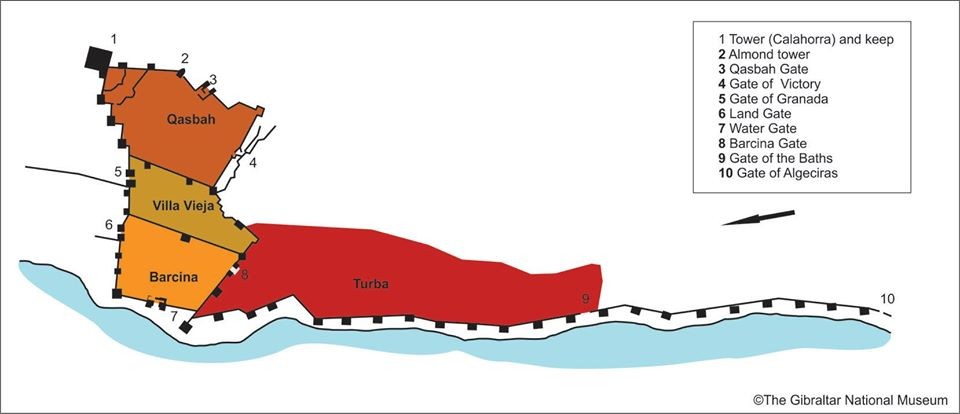
In the 1990s, some structures (walls) were recorded at the junction between Grand Casemates Square and Main Street. Due to their location and characteristics, we interpreted them as being the Gate of La Barcina (‘Puerta de la Barcina’) and the wall that divided the area known as ‘Villa Vieja’ (Old Town) from ‘La Barcina’, according to the plan of Gibraltar by Luis Bravo de Acuña (1627) and the accounts of Alonso Hernández del Portillo.
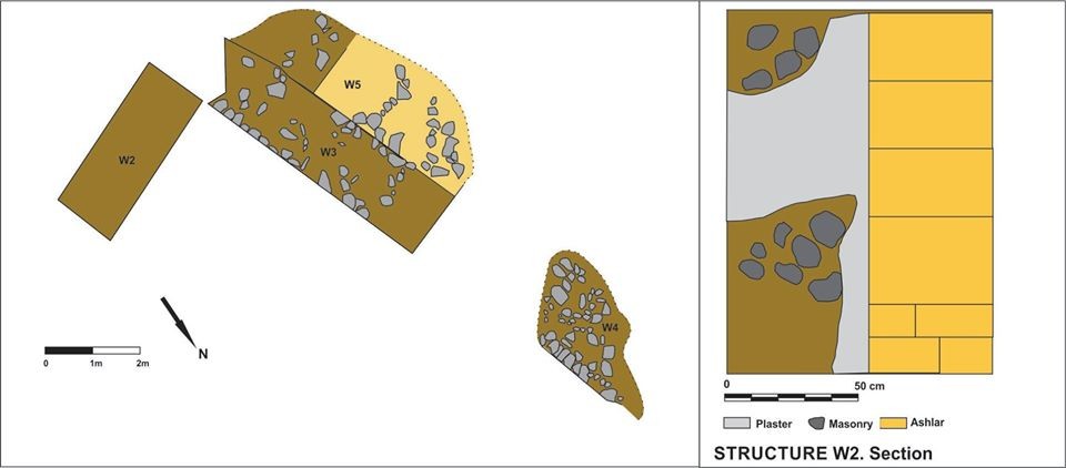
One of the walls (W2 in the plan) was constructed from rendered masonry combined with vertical columns of sandstone ashlars, and is interpreted as being the boundary wall between both areas of the city.
The other recorded structures (W3 and W4 in the plan) could be interpreted as the gateway and communication between ‘La Barcina’ and the ‘Turba’ neighbourhood. The upper part of the wall which has survived presents quadrangular ashlars roughly joined by mortar. The lower section consists of masonry, also without a predetermined layout. It was made with different-sized, irregular limestone blocks, joined by a mortar of lime, sand and clay. An interior paving could be observed from which some poorly-conserved steps begin to ascend, which would have given access to an upper floor. This would have been the tower that can be seen in Bravo de Acuña’s plan which could in turn correspond to the so-called Flag Tower in early British documentation.
Other similar VM - Archaeology
18-20 Bomb House Lane
PO Box 939,
Gibraltar